Where sea, land, and art meet on the horizon
Vlieland

Where sea, land, and art meet on the horizon


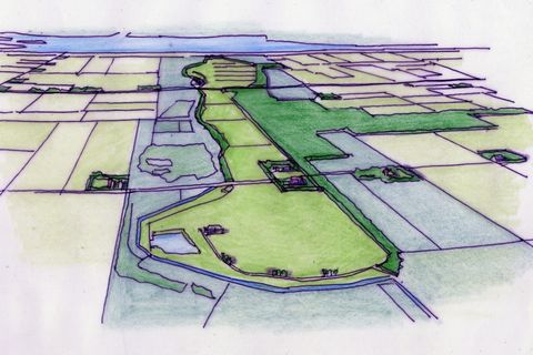
On abstract maps, the isles in the North Sea (the so called ‘Waddeneilanden’), seem like a string of pearls which have been blown towards the coast with the usual northwest wind. As with a string of wild pearls, all isles are different and at the same time they make a whole. You get a completely different impression from a satellite photo of this area, where you see the shallow area of the Wadden Sea and how the sand is washed around the islands. The islands seem to be pushed away from the coast in a playground of flats and waterways. 

The Wadden Sea took shape after the Pleistocene as result of the increasing level of the North Sea. Sand dunes were formed in front of the coast, reflecting a kind of teamwork between shifting sands, tide changes and floods by storms. Sand dunes became dune islands and plains of sand. The islands, influenced by sea and wind the islands wander from west to east. Schiermonnikoog actually crossed the border of the provinces of Friesland and Groningen. The area between land and sea became a fordable landscape and is now called the Wadden Sea. The changing tides along the coast of the Wadden Sea are enough to put this area both under water and dry again twice a day. The area is full of nutrients and that is why you see so many birds that feed and breed here. 

The Dutch consider the Wadden Islands as quite common because the area is so close to the mainland. Yet they are not common. It is not without reason that the Wadden Sea has been included in UNESCO’s World Heritage List since 2009. It needs to be protected against the influences of sea and man, especially now people are seeking new areas to drill for natural gas in the North Sea. 

The Wadden Islands spread across multiple countries in Europe (Netherlands, Germany, Denmark). Not everybody in Europe agrees on the number of Wadden islands. Is a sand bank also an island? The Dutch are used to saying that they have five Wadden islands, but you could also count Razende Bol in front of Texel, Griend in front of Vlieland and Terschelling, Rottumerplaat and Rottumeroog en Zuidenduintjes as well, which brings the number to ten. The Germans have twenty islands and also nine Halligen (small islands behind dikes). Do you know that the German islands above the federal state of Niedersachsen are all smaller than the smallest of the Dutch Wadden islands, Vlieland? Vlieland has 39.15 square kilometres of land, with 1200 inhabitants, slightly more than Schiermonnikoog, the next smallest of the islands. Denmarks situation is clearer with four of the bigger Wadden islands. Our intention is to visit them all, but we still have a long way to go.

When we talk with other people who visit the Wadden Islands, we notice that everyone has a favourite island, and they all differ. We know people who own a boat, and they love Terschelling the most, as boats enter the harbour right into the heart of the main village. If your forefathers are from Ameland, as is the case with Jan, then you are not allowed to have a different favourite island that differs from where your roots lie and definitely not Terschelling. There has always been rivalry between these two islands. After several visits to the Dutch Wadden Islands, it has become quite clear to me that Vlieland is my favorite and I hope to be able to explain that to you. 

The trip to the island
There is no doubt that the nicest harbour to leave to go to a Wadden island is Harlingen. It is an historical city on the coast of the Wadden Sea, accessible by train, with a ferry in walking distance from the railway station. It is not a town that you want to leave immediately; it invites you to visit…but we will leave that for another time. Harlingen harbour has a huge ending where the ferries can turn before the bow of the ferry sends you in the direction of the Wadden Sea. You get your money’s worth sailing to Vlieland. The island is the most remote of the Dutch Wadden Islands, the longest distance to the coast. Before the Afsluitdijk was built, Vlieland also lay at the Southern Sea (Zuiderzee), which we now call a lake, the IJsselmeer. The ferry follows the same way as to Terschelling, the neighbour island, until you pass the sign Richel – and are wondering if you won’t sail past Vlieland – to make a sudden left turn, pass the harbour named Aanloophaven to go to Veerhaven. It is true that arriving at the village in Terschelling is more in the heart of the village then here in Oost-Vlieland. However, you are in the main street (Dorpsstraat) of the only village on the island in no time, as you will see later on.

This was not always how one sailed to Vlieland. At the end of the 19th Century, you would have taken the ferry to Terschelling and transferred – on the high seas – onto a barge that would take you to Vlieland. If you go back further in time to 1668, you would have taken the post boat, Vlie-Post.  The city of Amsterdam allowed a regular postal connection from North-Holland via Texel to Vlieland. The post would bring messages from the shipping companies and would record which ships were spotted. A courier on horseback took the letters to the edge of the island, Vliehors, in the outmost southwestern part of the island. This was only possible at low tide. The post was there handed over to the skipper who sailed in an open boat to Texel. A was built halfway, now a café restaurant with the name Posthuys. The courier could spend the night there and wait for the right tide to come. The posthouse became a stopover on the route with two postal runs: one to the village and the other to the boat to Texel. This ended in the 1920s once the ferry connection with Harlingen commenced.

Island with dike, dams and dunes
Of all the Dutch Wadden islands, only Vlieland is without any agricultural land or meadows. This means that you don’t see farms, crops or cows. If you do spot an animal on the island, there is a big chance it is a goat. As the saying goes: there is nothing to be mowed or sowed on Vlie (as the island is tenderly called). This means that the island is dependent on the mainland for almost all its food. 

The dike
The dike

The break in the dike is the start of the main street, Dorpstraat. Just before you reach this point coming from the harbour, you can climb up the dike and pass the statue of Willem de Vlamingh (1640-1698). The statue is a deposition of the importance of Vlieland during the period of the Dutch East India Company and the expedition of its hero from Vlieland to Australia in 1696-97. A path of bricks lays on top of the dike that was built in 1825. The dike was raised in 1932-1939 and stones were added on its side. The dike was raised again in 1958 to its current height of 5.55m (Dutch Standard Level). Although this is manmade, the dike seems kind of friendly. It is much lower and less in straight lines than the raised dikes on the other islands. You can walk from this small dike straight to the mud flats of the Wadden Sea. You can sit on benches that seems to be sunken into the dike that keeps the cold north wind off your neck as you see the mud flats come dry. On the other side of the dike there is a rear dropout for the houses on the Dorpstraat. These houses all have deep back yards looking to the south (sunny side). There are only two spots where a building lies next to this path. The oldest one is the of Betzy Akersloot-Berg in the garden of the museum Tromp’s Huys (which I will explain later). Closer to the start of the dike is a similar building in two storeys (which had a role in the television series of Dokter Deen which took place on Vlieland). 

Those who know their way around the other Dutch Wadden islands, know that numbered poles in the sand are used to know where you are on the beach. Vlieland uses numbered dams rather than poles.  The Directorate-General for Public Works_and_Water_Management started to build dams in 1854 at a right angle with the coast  to protect the island against the sea. These dams are 300 metres long and are made by hand with willow, poles, rubble and basalt. Work commenced on the west heading east. Dam 52, near Kaap Bol, was finished in 1884. At the beginning of the 20th century they started to build the dams on the eastside of the village, even using a steam engine locomotive. Coastal erosion was so quick that the dams were not built every 180 to 200m but double this distance. They planned to build the missing dams in between later, but that appeared not to be necessary anymore. Therefore, there are no odd numbered dams. 

The row of dunes at the North Sea Coast is high. It is quite a climb to get over the summit and you can only walk over the dunes at a limited number of places. Such a climb is quite worthwhile because you can look over the whole island, from the North Sea to the Wadden Sea. Vlieland has the highest dune of the Dutch Wadden Islands. The Vuurboets dune is 43 metres high. By building the lighthouse on the dune, it only had to be 18m high to let the light shine at the same height as on the other islands. The we see today was built in 1909; it was the upper part of a lighthouse from IJmuiden. Vlieland, in 1918, was the last municipality in the Netherlands to get electricity and then the oil lamps were replaced. The old copper rooftop was replaced by an outstanding red plastic top in 1988. Very near to the lighthouse you can find the cheese bunker where special cheeses are made.

East Vlieland
East Vlieland

History
Vlieland was separated from Texel by the Eyerlandse Gat in the 13th century. The monks of the Ludinga monastery had received Vlieland and Eyerland as a gift from Count Willem II and they made a waterway to better connect using the sea. Nature took the opportunity to fill this waterway and divide the two islands definitively. This explains why Vlieland was part of the province of North Holland, at least until 1942. 

Without the possibilities of agriculture and cattle breeding, the island was fully dependent on the sea and the shipping industry. It prospered in the 17th and 18th centuries because of the site and excellent anchorage for the ships to the colonies. The sea mouth known as the Vlie was a gathering point for ships. At low tide you could get very close to the ships, and it was easy to stock the ships with the local beer, coming from one of the four breweries on the island. Pilots, fishermen and tradesmen lived on the island. Quite a large part of the population sailed on the East Sea or one of the oceans, especially in the peak whaling years.  You can still see traces here as the jaws of the whales were used as gravestones. They would erode in this climate, therefore are now placed inside the church instead of standing in the graveyard. There is one replica on the graveyard with the words (in nowadays English) ‘1758 lies buried Antien Reynder who has slept in the Lord in 1788 RRA.’

Vlieland is known historically for its eternal battle against the sea. There used to be another village, West-Vlieland, that time after time was washed away by sand and sea and was repaired after every blow. The flood of 1680 was the beginning of the end, and the village was left bare at the North Sea, without protection by the dunes. The population left the village, except for the poor who couldn’t afford to leave. With the February storm in 1714 the church and several houses disappeared into the sea. Even the newly built church was taken by the sea in 1727. The last houses were evacuated in 1736 after which the remains were washed into the sea or the materials were saved to be reused in Oost-Vlieland. 

The French period (ruled by Napoleon) left the Netherlands in a poor state at the beginning of the 19th century and it was the end of its booming period. The population in Vlieland decreased to just 580 in 1824 and there was widespread poverty on the island. When the North Sea Canal was built in in 1876 and steam engine boats were invented, it almost meant the end of the island. They even tried to cultivate pieces of dune to plant potatoes, but the sand drifts made this a ‘mission impossible’. 

The rescuer of the island was Nanning Willem Duinker, a skipper from Texel. He saw the potential for tourism on Vlieland. He established the company Northsea Bath Vlieland in 1895, and a company called Vlielands Interest which later became the tourist office was established in 1906. One year later the first hotel opened, it is now known as Badhotel Bruin. Mr. Duinker leased a piece of dune land from Staatsbosbeheer and the first holiday homes were built in about 1933. The first three are dome shaped – with the lovely names ‘Sonnevanck’ ‘Open Zon’ and ‘Zon Rondom’ – for the labourers who worked on the building of the Afsluitdijk. The area at the end of the Badweg is called Duinkersoord and holiday homes are still being built there, all within a reasonable distance between each other. A bathing pavilion came and a bit later the Bath and Beach Hotel (Bad- en een Strandhotel). Bathing was not yet something one did for fun but was meant to improve your health with the fresh sea air and water. The province of North Holland was still not convinced that Vlieland had a future and seriously considered evacuating the island, as occurred with Schokland in 1857. The Directorate-General for Public Works was the organisation that believed in keeping the island; they took over the finances (and liabilities) and became the local employer for planting and maintaining the woods against the sand drifts.  

The huts
The huts

Architecture
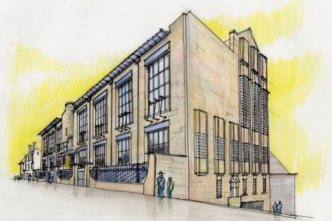
Architecture is usually not a topic that one would expect about a Wadden Island. Yet it is worthwhile for Vlieland. It starts with the great diversity of buildings at the Dorpstraat. The former post office of 1900, now hotel (Loodshotel), stands at the beginning of the street behind the break in the dike . Further on, you can find the oldest building Tromp's Huys (1575) and the old town hall – which is not quite as old as you think reading the plaque from 1596 which was removed from the previous building – which was actually built in 1855. 

If you walk further through the Dorpstraat to the west, you will find quite a few new buildings. What stands out is that a lot of attention was paid to the visual building quality; these buildings fit in quite well with the older buildings and yet are modern at the same time. The church stands on the church square (Kerkplein) that was never designed as a square. The church was built in 1640 and enlarged in 1647. On the west side you can find the Poor House (Armenhuis), the old men and women’s home from 1622 that seems to be in coherence with the church as it is built with the same yellow bricks. The Nieuwstraat ends at the church square and at this street quite a few houses have been built by the social housing company. You don’t find this number of social houses on any of the other Wadden Islands. 

New houses were built in 2021, almost against the dunes the end of the street. Other new buildings can be found closer to the harbour, for example at the Lutinelaan, with a hotel-restaurant on one side and new houses on the other. It is good to walk along this street further to the north. You will find the library, The Beachcomber (De Jutter), by Kristinsson Architecten in 2016. The importance of safeguarding the visual building quality can also be seen on Duinkersoord.   

Beach art
Beach art

Art
The relationship of Vlieland with art is the icing on the cake. It is not something one would expect on such a small island with a small number of inhabitants. Next to the places where you can cross the dunes to go the beach, you will find artwork with the title ‘Come along and rescue the sea!’. Attention is drawn to all the waste, especially plastic, that is dumped into the sea. The art uses plastic bottle tops that came ashore in the summer of 2016 and were found along the Dutch coastline, participants of the yearly clean-up of the North Sea Foundation made paintings resembling seascapes.

You can’t miss Betzy Akersloot-Berg (1850-1922), a Norwegian artist who found her ideal working space on Vlieland. She was born in Christiania, as Oslo was called in those days. She went to the North Cape as a nurse to be financially independent from her parents. She had a passion for painting, especially the sea. She started painting again once she returned and could even sell a couple of her paintings. She first came to Vlieland in 1895 via a friend who lived in Harlingen. She sailed to the island and had to change boats halfway on the full sea. Betzy was quite fearless and had even been on a whale hunting trip. That was quite unusual for a lady in those days. She felt at home on Vlieland and it reminded her of Magerøya in the north or Norway. 

Betzy wandered a lot over the island and painted coasts, dunes, the graveyard, stranded ships and the sea. She had a box made in which she could sit on the beach out of the wind while drawing in her sketchbook. One of her characteristic stories is her painting of the stranded Norwegian barque, Perlen. She not only painted the ship but also a drowned body. The mayor thought that quite indecent and forbade her to finish the painting. She didn’t want others to tell her what she could or could not do and paid an inhabitant to lie on the beach so she could finish the painting. 

She rented a house together with her husband Gooswinus Akersloot (1843-1929) until the opportunity arose to buy the white painted house that belonged to the family Redeker across the small path called Molenglop in 1898. It was the oldest house on the island, dating 1575. They called it Tromp’s Huys (House), after Maarten Tromp (the father of Cornelis Tromp) who was the commander of the Norwegian fleet of the King of Denmark and who conquered the Swedish fleet. In the backyard, right next to the dropout at the bottom of the dike, there stood a small shed. Betzy immediately had the idea to build a working space on top of the shed and ordered a Norwegian construction box to realize it. She only once made a painting of her working space. She has spent many hours in this room, even the last day of her life. She then finished her last painting, ‘I am the blinking morning star’ and died on 29 December 1922. The gravestone of Betzy and her husband can be found in the graveyard. The house with all the furniture and paintings was left to the housekeeper after the passing of Gooswinus and she didn’t dare to change anything. The house is now a museum and gives a good impression of how one lived in those days. The working space can be rented so you can experience the view by yourself, and fortunately you can still look over the dike. 

The other link to art is literature. Jan Jacob Slauerhoff was born in 1898 in Leeuwarden as the fifth child in his family. His father, born in Friesland, had a well-known upholstery and furniture shop in Leeuwarden. His mother, Cornelia Pronker, was one of nine children of a pilot from Vlieland. The family Pronker were a seafaring family for more than 400 years. Mr. Slauerhoff had a weak constitution but coped quite well on Vlieland. In his youth he frequently visited the island with his mother, stayed with his sister at his uncles and went to summer school. After his diploma at the so called HBS – where he became interested in literature for the first time and started to write poems – he studied medicine at the University of Amsterdam and received his degree in 1923. Later he would frequently stay at the house of Doctor Terwisga on Vlieland. He even considered taking over his practice, but he wanted to travel – in spite his poor health – and he became a ship’s doctor. On the 70th anniversary of his death, on 5 October 2006, a walking path was set out on the island marking places that played a part in his life, or which could be connected to his work. A glass panel is now placed with a fragment of a poem in fourteen places. A plaque is placed on his house at Dorpstraat 27. A family descendant, Tom Pronker, has produced an interesting booklet with the route, called Wandelen op Vlieland met Jan Slauerhoff (only in Dutch). 
The following lines from his poem ‘Old’ appeals to me: 

‘Over my boat, tilted, half in the sand
Lifted high on the beach by the last spring tide
A girl goes, skirts in hand
As she sailed – how slender she seems, young, wild – 
Above the waves, touching the edge of life
Leaning only on the wind’

He loved the sea enormously, just as Betzy Slauerhoff, as you can read in the poem called The Sea in the following lines:

‘The sea, the only life that stretches
From beginning to end
While all the others, briefly awakened
Meek in eternal breaking
The great soft ring of the sea
That, when all die, stiffen
She will remain gracefully.‘

If you become inspired to write poems yourself, the Vliehors Express gives you an opportunity to have your lines printed in the sand by the special tyres of this vehicle. They have been doing that since 2003. The Vliehors Express brings you to the Vliehors, the wide sand plain that covers about half of the island and is also called ‘Sahara of the North’. This area is only accessible outside of bird breeding season. It used to be the area of the Airforce and Cavalry Shooting Camp (CSK) until 2004, but the airforce still practises here regularly. The conditions for the poem tracks are that you put your feelings about the sea into a maximum of 112 signs divided over two lines. The winning poem will be printed during one season, about 5.5 million times in the sand of the beach of the North Sea. We found the following poems during our last visit and have nothing to add:   

‘What makes the deepest impression was touched by water'

'Not disturbed by anyone, the sea takes the last word’
‘I load my heart full of the Wadden Sea a little secretly without questions' 

'I take a little Vlieland with me, as much as I can carry’

2022

Share this article